Primorsky Krai is a subject of Russia located in the Asian part of the country (southeast). It is part of the Far Eastern District. The administrative center is the city of Vladivostok.
The region covers an area of more than 164 thousand square meters. km, and the population (01/01/2016) is 1 million 929 thousand people.
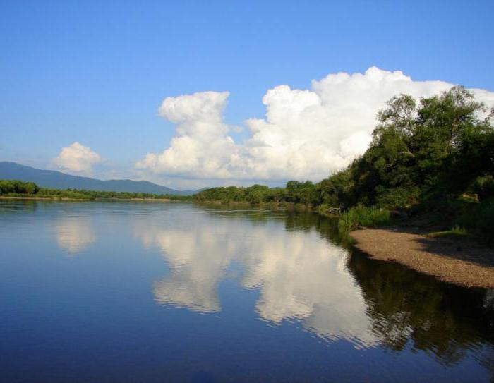
Rivers and lakes of the Primorsky Territory occupy a considerable part of its territory. They are of great economic importance for water supply and as spawning grounds for salmon fish.
Geography and relief of Primorye
Before we introduce the rivers of the Primorsky Territory, we briefly consider the geography of these places. For the most part, the land is a mountainous country by the nature of its relief. Only 1/5 of its territory is occupied by river valleys and low-lying intermontane depressions. The Ussuri-Khankaiskaya (Prikhankaiskaya plain) is the largest lowland that occupies about 20% of the region’s territory.
About 4/5 of the territory is occupied by the ridges of the Sikhote-Alin mountain range, stretching from the north-eastern part of the region to the south-west. It can be considered as a system of ridges parallel to the coast of the Sea of Japan. The highest peaks of the ridge: Anik (height 1933 meters), Cloudy (height 1855 meters), High (height 1746 meters) and Snezhnaya (1684 m).
Rivers of Primorsky Krai: general information
In Primorye, a total of more than 6,000 rivers flow, of which only 1,650 extend over distances of more than 10 kilometers, and 91 to 50 kilometers or more. Their total length in the region is approximately 180 thousand km.
The largest river in the Primorsky Territory of Russia is Ussuri.
A characteristic feature of the rivers of these places is their relatively small extent. This is due to the fact that the watershed line runs off the Pacific coast.
The main watershed in the south of the Far East is the Sikhote-Alin Range. From its steep eastern slope, rivers flow into the Sea of Japan, from the western slope into the r. Ussuri and Lake Khanka. From the slopes of the mountains of the East Manchurian rivers flow into Lake. Khanka, in the Gulf of Peter the Great and in the Razdolnaya River.
Most of the rivers in their upper reaches are mountainous. There are approximately 30 waterfalls on them, the most picturesque of which are Amginskiy, Milogradovskiy, Benevskiy and Shkotovskiy. The middle and lower reaches of the rivers have extended valleys with reduced slopes. Therefore, here they flow more calmly, forming loops and ducts. Mostly all rivers have rainwater supply, and therefore they are distinguished by large floods in July-August (typhoon period). They acquire a particularly catastrophic character in the Ussuri River basin.
By their nature and by the landscape of the coasts, the rivers of the Primorsky Territory are quite interesting and attractive for tourists.
Description of hydrological areas
5 districts are allocated throughout:
Central Sikhote-Alinsky in its composition has the upper and middle reaches of the following rivers: Bolshaya Ussurka, Khor and Bikin. Also included here are the basins of their largest tributaries. These rivers are characterized by high water abundance.
In the Western Sikhote-Alin, the upper reaches of the Ussuri River enter .
As part of the East Sikhote-Alin region, the river of the Sea of Japan is northeast of the mouth of the Zerkalnaya river.
In the South Primorsky region, rivers of the Sea of Japan basin located south of the Zerkalnaya River, reservoirs of P. Great Bay, some rivers of the Lake Basin flow. Hanka, as well as the middle and upper reaches of the river. Commissar.
In the West Primorsky district there are basins of the Ilistaya, Melgunovka, Belaya, Spassovka, Ussuri (middle flow), Bolshaya Ussurka (lower flow) rivers. Only Sungach flows from Lake. Hanka and its water is in the river. Ussuri. The rivers of the Primorsky Territory of this region are relatively shallow, and in the summer many of them dry up and freeze in the winter.
Edge nature
The vegetation and animals of the Primorsky Territory are extremely unique. This is due to the geographical position of this area, a complex terrain and a peculiar climate. There are about 3,000 species of higher plants only. The Ussuri taiga, famous for its natural wealth, extends over 2/3 of the entire territory of the region.
The magnificent, fabulous nature attracts many tourists and travelers here. These regions and fishermen have chosen. Many lovers of a rich catch dream of visiting the rivers of the Primorsky Territory.
Fishing
The rivers of Primorye are not only distinguished by their picturesqueness.
Fishing on the rivers of the Primorsky Territory is the main and favorite pastime of local residents and many visitors.
The taiga rivers Zeva, Muraveika and Bikin are especially attractive here for fishing. They can catch chum salmon, pink salmon and salmon.
Ussuri (a tributary of the Amur) is also distinguished by a variety of river living creatures. In these parts, fishing on grayling, taimen, crucian carp, lenok, common carp, catfish and silver carp is the most popular.
Kema, which flows into the White Sea, is also a favorite place for fishing enthusiasts. Here they have all the conditions for a comfortable stay. There is a sim, trout, char, etc. in this river.
Conclusion
Not only the rivers of the Primorsky Territory are natural attractions of these amazingly beautiful places.
It should be noted that the territory of Primorye is rich in other unique natural monuments: karst caves, extinct volcanoes, lotus lakes, etc. There are cozy bays with beautiful beaches, mineral springs, therapeutic mud, as well as the waters of the Sea of Japan. All this creates excellent conditions for the recovery and relaxation of man.
The huge wealth of flora and fauna of Primorye, the uniqueness of the stunning landscapes brought these places world fame.