The total number of rivers in Germany amounts to several thousand. Among them are full-flowing giants (Rhine, Mine, Spree), and even tiny rivulets, the channels of which can be crossed without much effort. This article is dedicated to the Weser River, which is completely within the country. Where does it start, where does it flow, and what is its total length? Let's try to answer all these questions.
Watercourse Overview
Weser (German: Weser) is a river in Germany flowing in the northwestern part of the country. On its way, it crosses the German midlands and the North German lowland. It flows into the North Sea, the mouth is located near the port city of Bremerhaven. This is the largest watercourse in Germany among those that completely flow within this state. On the map below, the river is highlighted in purple.
Weser River in facts and figures:
- The catchment area: 46 306 sq. km
- The volume of average annual flow: 327 m 3 / sec.
- The length of the Weser River: 452 km.
- Slope value: 0.26 m / km.
- The largest tributaries: Aller, Lune, Lesum, Emmer, Okhtum, Kalle.
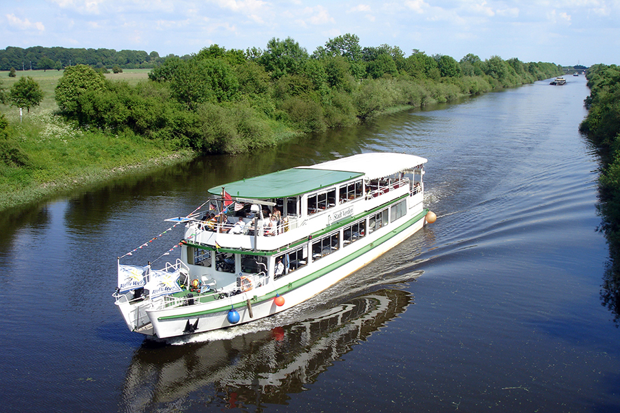
Weser flows through the territory of three federal states: Hesse, North Rhine-Westphalia and Lower Saxony. Navigable from the mouth to Minden. The largest settlement on the river is the city of Bremen.
The name of the river and its origin
The hydronym is closely associated with the Latin visurgis and the ancient German visuri. Both words come from a single Indo-European root - ueis, which translates as "flow, spread out." It can be found in the names of many water bodies in Europe. Here are just some examples of such rivers: Vishera (Russia), Vistula (Poland), Visa (Sweden), Vizans (France).
By the way: the name of the Weser River gave its name to a special architectural style - the Weserrenaissance. It gained distribution precisely in the valley of this Germanic river in the XVI-XVII centuries, combining the features of the Italian and West European revival. Perhaps the most iconic building in this style is the famous Bremen Town Hall.
Weser Source
The Weser River begins at an altitude of 116 meters above sea level within the ancient city of Münden. The coordinates of this place are as follows: 51 ° 25 ′ 17 ″ north latitude and 9 ° 38 ′ 53 ″ east longitude.
The source of Weser is considered the confluence point of two other rivers - Verra and Fulda. The first of them is 74 km longer. At the junction there is a memorial stone with the following inscription:
Wo Werra sich und Fulda küssen
Sie ihre Namen büssen müssen,
Und hier entsteht durch diesen kuss
Deutsch bis zum Meer der Weser Fluss.
Translated from German, it sounds something like this: “Where Verra kisses Fulda, they will have to forget about their names. And here, as a result of this kiss, the German river Weser begins - and flows to the sea! ”
The similar names of the two rivers (Verra and Weser) clearly indicate that once there was no separation between them at all. Previously, Fulda was considered only one of the tributaries of the Weser. And only in the Middle Ages did a difference appear between them, including the names.
Nature of the Weser River
The course of the river over almost the entire length is smooth and low speed. In a longitudinal section, the Weser channel is usually divided into three parts:
- Upper Weser (also Oberweser) - from Münden to Minden.
- Middle Weser (Mittelweather) - from Minden to Bremen.
- Lower Weser (Unterweser) - below Bremen.
The starting point in terms of mileage of the river is in Münden. Here begins the Oberweser. The slopes of the river valley in this section are almost entirely covered with forests. On the shores of Oberweser there are many active and abandoned development of variegated sandstone. It was from this stone that most of the historical buildings in the region were built. The valley in this section of the river is quite narrow, but in some places it is noticeably expanding (for example, at Hexter or between Hameln and Rintelnom). In the city of Hameln is the only dam on the river. At about 200 kilometers of its length, Weser enters the vast North German Lowland.
The conventional boundary of the Upper and Middle Weser is Minden. Near the northern outskirts of the city, the Central German Canal crosses the river. Up to Schlusselburg, Weser flows through the expanses of the North Rhine-Westphalia, and then its path runs through the territory of Lower Saxony. The Mittelweather ends at the Hemelinger Dam.
The Lower Weser section is highly susceptible to tides. At one time, the riverbed was artificially straightened. As a result, the tidal height in the Bremen area increased from 0.7 to 4 meters. The Weser River ends with a mouth, which is located in Bremerhaven.