Some historians interpret the name of this river as a derivative of the Turkic word "maturlyk", which translates as "beautiful." But this version is not recognized by all toponymists. There is another version about the origin of the name, according to which Matyra in translation means "rushing river, bustling along the valley."
There is one interesting opinion regarding this area. The city of Makhtura (or Matura), mentioned in the ancient Indian epic Mahabharata, located in Kurukshetra (Oksko-Don Plain, Kursk Field), was located at the mouth of the Matyra River, at the place where it flows into the Voronezh River. It was by the name of this river that the name was given to the village of Matyrsky.
General information about the rivers of the Lipetsk and Tambov regions
In total, there are 127 rivers with a length of more than 10 kilometers, about 200 streams and about 2,200 sources in the territory of the Lipetsk Region. The largest rivers are the Don (1870 km long) with two tributaries (Pine and Beautiful Swords), Voronezh with the tributaries of Matyr and Stanovaya Ryas. Almost all water bodies, except Ranova, belong to the Don basin. Basically, the sources of rivers in this area are keys, groundwater.
193 large rivers with a length of more than 10 km flow through the territory of the Tambov region. Water here is one of the components of the landscape. The Tsna River is the largest river in the region, which is the left tributary of the Moksha River (Volga basin). Its length is 446 kilometers, 291 of which belong to the Tambov region.
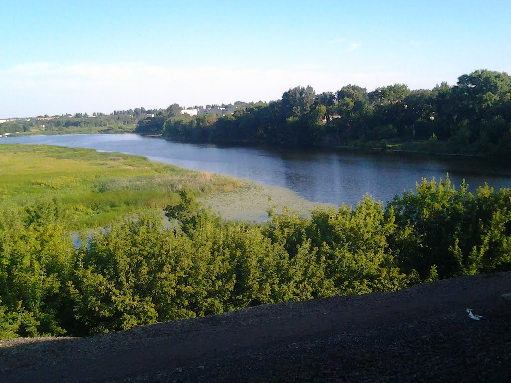
River description
The Matyra River flows through the territories of the Lipetsk and Tambov regions of Russia. The total length is 180 kilometers, the area is 5180 km 2 . She takes her start from the village of Bolshaya Matyra, not far from the highway of the direction Oryol - Tambov. It becomes full-flowing after the confluence of the Plavitsa River (the village of Yablonovets). At the border of the city of Lipetsk, the river flows into the river. Voronezh (near the village of Sokolsky). In the Lipetsk region, the river receives the waters of Baigory, Samovets and Lukovchanka. The upper reaches of the Samovets river are already in the Tambov region. There is a reservoir on the river (in more detail below) in the Lipetsk region. After the dam, the river narrows and flows through marshy areas.
The Matyra River in the Tambov Region has a length of 120 km. The basin in its northern part borders with the basins of the Polnaya Voronezh River and the Lesnoy River, in the east, with the river. Values, and from the south with the Bityug river basin. Forest cover is small, as in the Lipetsk region. Forest vegetation is concentrated in areas and mainly in the upper reaches of the river - Matyrskaya Dubrava. It is located in the area of rural settlements Krutoe, Bol. Znamenka, Shekhman and Yablonovets. In the Tambov region, Shekhman and Izberdey flow into the river on the right, and Gryaznush, Ploskush, Goby, Plavitsa and Mordovka on the left.
The water supply is mostly snowy. The river freezes from November to December, and opens from late March to early April. At 39 kilometers from the mouth, the average annual flow rate is almost 12 m³ / s.
For information, the distance Lipetsk - Tambov on the highway is 135 kilometers.
Nature
Geographically, the river basin is located on the Oksko-Don plain. Finely hilly, weakly crossed by ravines and ravines, the area is covered mainly by steppe vegetation.
The soil cover is characterized by significant variegation: from ordinary chernozems to forest gray soils. There are separate small sections of the forest, mainly with pine trees, less often with deciduous trees (oak, aspen and maple predominate). They grow in the valley from the mouth of the Izberdeik River to the mouth of Gryaznushi. Forests are larger, stretching on the site of the Matyr reservoir (on two sides of the Kazinsky reach). It should be noted that the forest cover of the river basin is small, it leaves less than 5%, however, in these places the plowing of fields is high (75%).
Matyr reservoir
In 1976, a reservoir was created in the river of the Lipetsk region for the needs of a metallurgical plant (today it is a plant in Novolipetsk). It stretched from s. Annino for a New Life.
The area is approximately 45 square meters. km, length - 40 km, width - 1.5 km, and average depth - 13 m. The population living near the artificial reservoir was settled due to flooding problems. This is part of the city of Mud and several smaller rural settlements, which today no longer exist.
The Matyr reservoir is very beautiful and picturesque. On the shore among the forests there are recreation centers and sanatorium complexes for a comfortable rest and recovery.
Significance of Matyra
The largest left tributary of Voronezh has huge water content in comparison with other tributaries. The contribution of the Matyr River to the total water content is quite tangible.
If we compare the average annual water capacity of the Voronezh River before their confluence and after, the result is as follows: the influx adds about 40% of the water mass.