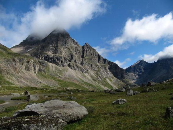
The majestic and severe beauty of Transbaikalia can be fully seen and appreciated on its mountain slopes. The region is divided into three parts: Western, Central and Eastern. Numerous ranges extend to the northeast. One of them is the Apple Ridge. They know about him not only in Russia. Due to its unique geographical position, it is known far beyond the borders of the country.
Location
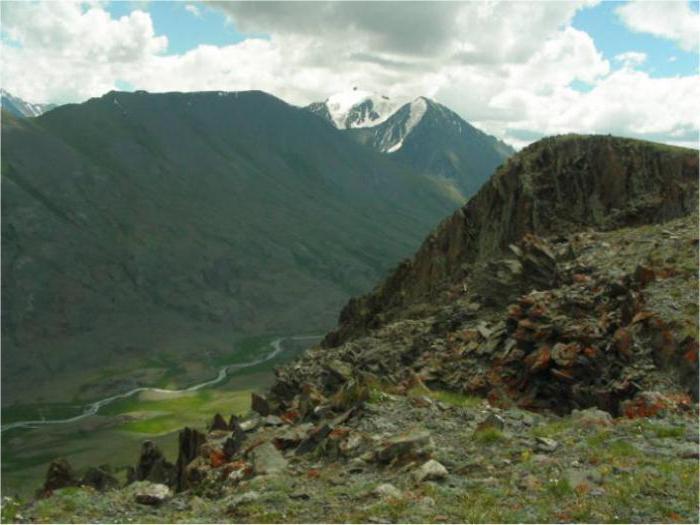
The area where the Apple Ridge is located is part of the central part of Transbaikalia. It is characterized by a sharply continental East Siberian climate. The mountainous part abounds with wide flat-topped ridges. This is a kind of border between East and West Transbaikalia. The apple-tree ridge stretches to the northeast and is the largest watershed of the Arctic and Pacific oceans.
Initially, it was considered one in common with the Highlands of Stanov. Cossacks who visited this area in 1643 considered the ridge continuous. The name "Stanovoy" means the main one, "the ridge of the Earth." This is a huge, more than 400 km long, system of mountains. The Russian geologist and geographer Vladimir Afanasevich Obruchev in 1895 was able to prove that the mountain ranges of Stanovoi, Yablonovy and Kentei (in Mongolia) are independent. Later, the name Yablonovy was preserved behind its first part: from the Daur Upland (Gobi Desert, Mongolia) to Lake Baikal, representing the northwestern part of the entire complex. From the northern tributaries of the lake to the Bureya River, the ridge is called the Stanovoy - the main ridge.
Description
Its total length is 650 km. The relief is mid-mountain, the mountains themselves include granite rocks, sandstones, and crystalline slate. The highest point of the Apple Ridge - 1706 meters above sea level - Kontalaksky Golets. Despite the alpine "homeland" and a rather high location, it does not go beyond the line of eternal snows. The slopes are covered with coniferous forests, pine and larch prevail, spruce and fir are less common. The western slope is a rather deserted mountainous region with deep gorges. At an altitude of about 1300-1400 meters, the tundra is replaced by a mountain tundra.
The geological structure of Central Transbaikalia is represented by igneous rocks, mainly granite. It is also noted at the Apple Ridge. Folding (a specific section of the earth's crust where rock layers are crumpled into folds under the action of the moving zones of the earth's crust) is characteristic of the Baikal zone. The mountains of Archean, Proterozoic, and also the Lower Paleozoic left their mark on the formation of mountains.
Title
Theories of origin of the name Apple Ridge are several:
- by name of the Yablon river;
- because of trees growing on the slopes of the mountains, giving fruits that look like apples;
- simply because apple trees really grow on the ridge;
- the pass road is strewn with small round stones resembling apples.
The most likely and plausible version is that the name came from the local dialect Yabylgani-Daba in the translation "foot pass" or "easily passable mountains." The unpronounceable name was gradually interpreted into the more familiar for the Russian ear - Yablonovy.
Sight
The Apple Ridge is famous for the Great Dividing Point. It was determined in 1982 by the expedition of the Trans-Baikal branch of the Russian Geographical Society. The peak itself has become a state nature monument of regional importance. Now it is part of the Ivano-Arakhlei reserve. The technical name “Dividing Mountain” was changed to Pallas Mountain (in 2012), another name is the Mountain of Five Seas.
For the first time, the feature of the mountain was noted by geography teacher Timur Zhalsaraino in 1977. Its uniqueness lies in the fact that it belongs simultaneously to the basins of the three largest rivers: the Yenisei, Lena and Amur. Such a geographical point in the world is nowhere else.
Rivers carry their waters to four seas:
- Yenisei in the Kara Sea;
- Lena in the Laptev Sea;
- Amur supplies water to two seas at once - Japan and Okhotsk.
True, the fifth sea, fresh, can safely be called Baikal.
At a height of 1236 meters a wooden sign is installed. This is the mark of the global watershed. In 2014, the Ministry of Culture of Transbaikalia announced a competition to create a sketch of the sign for Mount Pallas. According to the results of the competition, the group won under the leadership of Alexei Antipenko. Someday, the point of the global watershed in the far Transbaikalia will gain a worthy distinction.