Weather - a set of relatively short-term atmospheric phenomena - is difficult to predict due to the large number of factors affecting it and the variability of their impact. The atmosphere of the Earth is a complex dynamic system, therefore, to improve the accuracy of forecasting, it is necessary to take into account its condition in different regions at every moment. For several decades, meteorological satellites have been a necessary tool providing the opportunity to conduct atmospheric research on a global scale.
The beginning of space weather observations
The satellite, which showed the fundamental suitability of spacecraft for meteorological observations, was the American TIROS-1, which was launched on April 1, 1960.
The satellite transmitted the first television image of our planet from space. Subsequently, the eponymous global meteorological satellite system was created on the basis of devices of this type.
The first meteorological satellite of the USSR, Cosmos-122, was launched on June 25, 1966. He had on board equipment for shooting in the optical and infrared ranges, made it possible to study the distribution of clouds, ice fields and snow cover, as well as measure the temperature characteristics of the atmosphere on the day and night side of the Earth. Since 1967, the Meteor system began to function in the USSR, which formed the basis of subsequently developed meteorological systems for various purposes.
Satellite meteorological systems of different countries
The successors of the Meteor have become several series of satellites, such as Meteor-Priroda, Meteor-2 and Meteor-3, as well as devices of the Resource series. Since the beginning of the 2000s, the creation of the Meteor-3M complex has been ongoing. In addition, two spacecraft of the Electro-L complex were included in the number of meteorological satellites of Russia. With the first of them, having worked in orbit for 5 years and 8 months, the connection was lost in 2016, the second continues to work. It is planned to launch the third satellite of this series.
In the USA, in addition to the TIROS system, spacecraft of the Nimbus, ESSA, NOAA, GOES series were developed and used. Several devices of the NOAA and GOES series are currently in operation.
The European satellite meteorological systems are represented by the Meteosat series of two generations, MetOp, as well as the discontinued ERS and Envisat - one of the largest spacecraft launched into low Earth orbit by the European Space Agency.
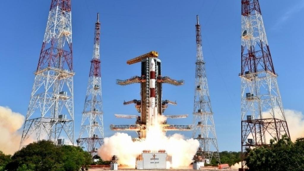
Japan ("Himawari"), China ("Fengyun"), India (INSAT-3DR) and some other countries have their meteorological satellites.
Types of satellites
The spacecraft included in the meteorological complexes are divided into two types according to the parameters of the orbit and, accordingly, according to purpose:
- Geostationary satellites. They are launched in the equatorial plane, in the direction of the Earth's rotation to an altitude of 36,786 km above sea level. Their angular velocity corresponds to the speed of rotation of the planet. Having such orbital characteristics, satellites of this type are always above one point, if you do not take into account fluctuations and “drift” caused by errors in orbit and gravitational anomalies. They constantly observe one area, which makes up about 42% of the earth’s surface — slightly smaller than the hemisphere. These satellites do not allow observing the regions of the highest latitudes and do not give a detailed image, but they provide the possibility of continuous monitoring of the situation in large regions.
- Polar satellites. Devices of this type move in much lower orbits - from 850 to 1000 km, and therefore do not provide wide coverage of the observed area. However, their orbits necessarily pass over the poles of the Earth, and one satellite of this type is capable of “removing” the entire planet’s surface in narrow (about 2500 km) stripes with a good resolution for a certain number of turns. With the simultaneous operation of two satellites located in solar-synchronous polar orbits, a survey of each region is carried out with an interval of 6 hours.
General description and characteristics of meteorological satellites
The spacecraft intended for meteorological observations consists of two modules: service (satellite platform) and payload (instruments). In the service compartment is located energy equipment that provides power from solar panels mounted on it together with a radiator and engine system. A radio engineering complex equipped with several antennas and sensors for monitoring the heliophysical situation are connected to the working module.
The starting mass of such devices usually reaches several tons, the payload is from one to two tons. The European “Envisat” record holder among meteorological satellites had a starting weight of over 8 tons, useful - more than 2 tons with dimensions of 10 × 2.5 × 5 m. With expanded panels, its width reached 26 meters. Dimensions of the American GOES-R - 6.1 × 5.6 × 3.9 m with almost 5200 kg of starting and 2860 kg of dry weight. The Russian Meteor-M No. 2 has a body diameter of 2.5 m, a length of 5 m, a width with expanded solar panels of 14 m. The payload of the satellite is about 1200 kg, the launch weight was slightly less than 2800 kg. Below is a photo of the meteorological satellite Meteor-M No. 2.
Scientific equipment of satellites
As a rule, weather satellites carry two types of instruments as part of their instrument complex:
- Sightseeing. With their help, television and photo images of the surface of land and oceans, cloud, snow and ice cover are obtained. Among these devices are at least two multizone imaging devices in different spectral ranges (visible, microwave, infrared). They take pictures with different resolutions. Satellites are also equipped with a radar surface scan.
- Measuring. Using instruments of this type, the satellite collects quantitative characteristics that reflect the state of the atmosphere, hydrosphere and magnetosphere. Such characteristics include temperature, humidity, radiation conditions, current parameters of the geomagnetic field , etc.
The meteorological satellite’s payload also includes an airborne data acquisition and transmission system.
Reception and processing of data on Earth
The satellite can operate both in the information storage mode with the subsequent transmission of a data packet to the ground-based reception and processing complex, and can conduct direct direct transmission. The satellite data received by the ground-based complex are decrypted, during which the information is referenced by time and cartographic coordinates. Then the data from different spacecraft are combined and subjected to further processing with the creation of visually perceptible images.
The World Meteorological Organization has adopted the concept of "open skies" declaring free access to meteorological information - unencrypted data coming in real time from satellites. To do this, you must have the appropriate receiving equipment and software.
International meteorological observation system
Since there is only one geostationary orbit, its use requires coordination between space agencies and meteorological (as well as other interested) services of different countries. And when choosing low polar orbits, coordination is not indispensable at present. In addition, satellite monitoring of hazardous weather events (such as typhoons) makes it necessary to combine the efforts of hydrometeorological services and exchange relevant information, since the weather does not know state borders.
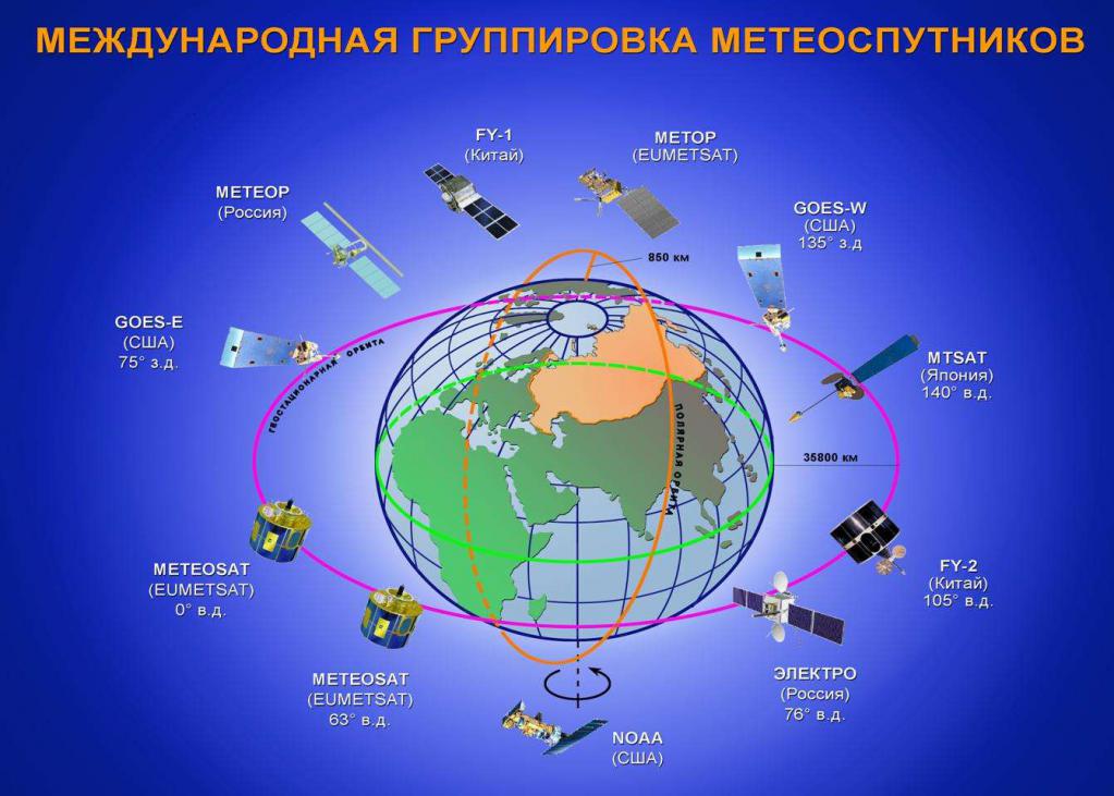
The coordination of international issues relating to the use of space systems in weather forecasting is under the responsibility of the coordination group for meteorological satellites within WMO. The sharing of satellite weather systems began back in the 1970s. The coordination in this area is especially important now. Indeed, the international constellation of meteorological satellites placed in a geostationary orbit includes spacecraft from many countries: the USA, European states, Russia, India, China, Japan, and South Korea.
Prospects for space technology in meteorology
Modern satellites, conducting weather observations, are part of the global Earth remote sensing system and as such have serious development prospects.
Firstly, it is planned to expand their participation in monitoring natural hazards, natural disasters, hazardous phenomena, and in predicting long-term climate changes. Secondly, meteorological satellites of the Earth, of course, should find more and more application as tools for gaining knowledge about processes in the atmosphere and hydrosphere, as well as about the state of the geomagnetic field, both applied and fundamental scientific significance.