Seen from above, Halong Bay with its rocky peaks growing from emerald waters is like a wonderful work of art created by the Creator himself. Exploring it, you feel yourself lost in the fairy-tale world of stone islands that form a fantastic beauty of the sea landscape. Due to the characteristic relief, most of the islands are uninhabited and are almost unaffected by human activities.
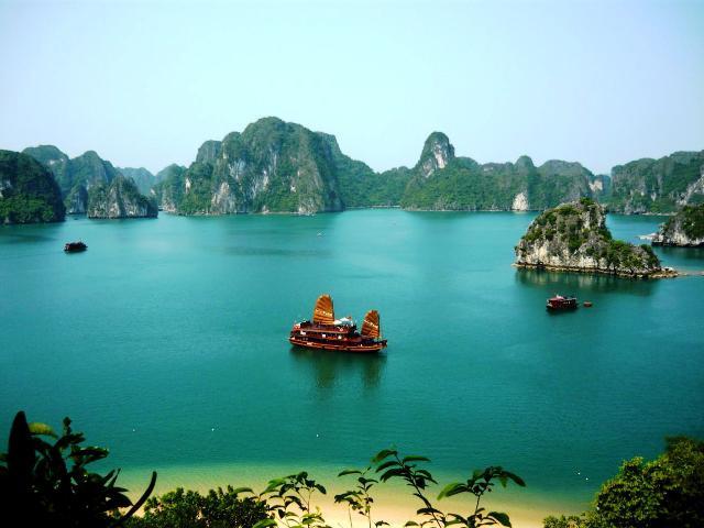
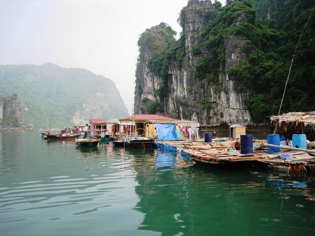
Halong Bay, located in the Gulf of Tonkin, bordering the East China Sea (in the east), has an area of just over 1,500 square kilometers. It is the center of a large zone, including Bai Tu Long Bay (in the northeast) and Kat Ba island (in the northwest). All regions have similar geographical, geological, geomorphic, climatic and cultural features. The coastline is 120 kilometers. This part of the country, located near the border with China, is known as Dong Bak (northeast Vietnam). Halong Bay is an area inhabited by many fishing communities, including four communes (Kyawan, Kongtau, Wongvieng, Bahang) with a population of more than 1600 people. People live in houseboats set up on barges, engage in fishing and aquaculture.
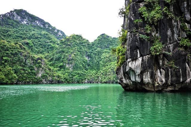
Geologists explain the formation of this submerged karst landscape as follows: in the Paleozoic era (between 543 and 250 million years ago), the place was in the open sea. Then a thick layer of precipitation formed. As a result of the movements of the earth's crust, pushing the seabed, rocky systems were formed. Rains and underground streams during geological time crowded out numerous grottoes. The collapse of some grottoes complemented the formation of a fabulous landscape composed of a group of conical peaks (feng kong), rising on average 100 meters (sometimes more than 200 meters) above sea level, and isolated turrets (fenglin) with a height of 50 to 100 meters. Many of them have vertical walls from almost all sides and continue to change as a result of the fall of stones and boulders.
The vast limestone caves that characterize Halong Bay are divided into three main types. The old phreatic, formed below the groundwater level, the ancient karst, formed at the foot of the rocks due to lateral erosion, and the sea - at sea level. Erosion due to constant successive regressions and sea progressions is another important factor in addition to the natural erosion of rocky islands. The main gutter dug along the entire length of the rocky coast is a wonderful illustration of this. Gutters are a common sign for rocky slopes throughout the world, but Halong Bay with its picturesque formations in different places in the form of arches and grottoes - is especially indicative. Large islands are distinguished by the abundance of lakes.
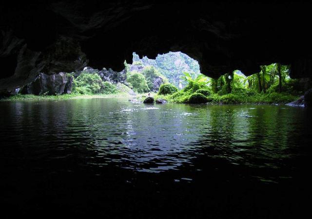
One of the most famous is Ba Ham on Daw Be. This is a lake system enclosed in rocks from all sides, consisting of three large marine basins connected by narrow and winding cave tunnels. At the entrance to the first visitors are greeted by a forest of stalactites and stalagmites, forming bizarre images of different sizes and colors. Several types of orchids, fig trees, palms grow on the island. Among the representatives of the animal world, the main inhabitants are golden monkeys, flying squirrels, bats, several species of birds. Despite the fact that Dau Be is located at a distance of almost 25 kilometers from the coastline, it is considered one of the main tourist areas in the region.
To enjoy the magnificent nature of the area, you can join a cruise tour. Many travel agencies offering excursions are located not only on the bay, but also in Haiphong and Hanoi. In general, in Vietnam, one of the most recommended routes for tourists is namely Halong Bay. Hotels in major cities of the country where tourists live also offer cruise reservation services.