Krasnodar Territory has been a subject of the Russian Federation since 1937. It is located in the south-west of the country and is part of the Southern Federal District.
Types of Ponds
In order to go on to describe the reservoirs of this territorial unit of the Russian Federation, it is necessary to clarify what this concept is.
A pond is a temporary or permanent accumulation of water, standing or with reduced runoff, in natural or artificial depressions. This term is also applicable to the seas and oceans, but in a broader sense. Temporary can be called elders and puddles, that is, those hydro-objects that arise in certain periods of the year, most often in spring and autumn floods.
Reservoirs of the region
Permanent objects of this type include lakes, ponds, reservoirs and specific reservoirs of the Krasnodar Territory - estuaries. The reservoirs are divided into artificial and natural. The first include reservoirs, dams, ponds and pools.
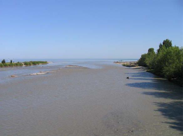
All of the above hydraulic facilities are located in the Kuban, most of which is occupied by the Krasnodar Territory. In the southwest and northwest the territory of the region is washed by the waters of the Black and Azov Seas, respectively. These are the largest natural reservoirs in the Krasnodar Territory.
Seas of the Krasnodar Territory
The Black Sea is washed by the border of the region from the Psou River, which serves as the border with Abkhazia to Cape Tuzla. The Kerch Strait connects it with the Sea of Azov, which is 11 times inferior in area to the Black Sea. The Sea of Azov is the smallest sea in Russia. In ancient times it was called the Meotian swamp.
These reservoirs of the Krasnodar Territory are sharply different from each other. So, the greatest depth of the Black Sea is 2210 (2245) meters, while the Azov Sea is only 14. The water in the first is very salty and below 200 meters is saturated with hydrogen sulfide, while in the second natural reservoir it is desalinated by large rivers - Kuban and Don, and salts contains little. The shores of the Black Sea are covered mainly with pebbles, while the Azov Sea is covered with shell rock and sand. And if in the Black Sea there are up to 180 species of fish, 40 of which are commercial, then the Azov until recently was generally considered the richest in fish stocks in the country.
The largest freshwater lake
In addition to the seas, lakes belong to large natural hydro-objects. Abrau, Kardyvach and Psenoda are fresh water bodies of the Krasnodar Territory of a similar type. The largest freshwater inland lake of the Krasnodar Territory is the Abrau pond, located on the peninsula of the same name (Abrau), 14 km from Novorossiysk. The pond is really big - its length is 3,100 meters, width - 630. The depth in some places reaches 11 meters.
The area of the mirror is 0.6 square kilometers. Scientists argue about its origin - someone considers it karst, someone - formed as a result of a landslide. There are suggestions that the lake is the remnant of the ancient Cimmerian freshwater basin. The lake is very clean, as evidenced by the presence of a large number of crayfish on the shores. In addition to them, the
Abrau tulk is also found here
. As noted above, the lake is closed, and only one river flows into it - the Durso, as well as numerous mountain streams. Nevertheless, without natural drains, the lake is shallow. It becomes shallow and silty, despite the measures taken. Next to it there is a small Dolphin Lake, the depth of which reaches 7 meters. It is adapted to work with marine animals - a dolphinarium is built here.
Interesting names
The name of the reservoirs of the Krasnodar Territory, each of them, sounds very beautiful and mysterious and is often shrouded in some legend. Lake Abrau and the river Durso flowing into it, combined in the name of the rural district, are associated with a beautiful legend of unhappy love. And the name of the second largest reservoir in the Krasnodar Territory, Lake Kardyvach, is translated from the Abazin language as "in the clearing inside the hollow."
Kardyvach Lake
All water bodies of the Krasnodar Territory are beautiful, Kardyvach is often called the dream lake. Located 44 km from the world-famous resort of Krasnaya Polyana, located at an altitude of 1838 meters above sea level, this almost regular oval-shaped pond is a favorite tourist destination and part of the biosphere reserve. Often the lake is called a mirror - in it, in addition to the beautiful shores, the snow-capped peaks of the mountains are reflected.
The Mzymta River flowing from it is the longest of all rivers and streams flowing into the Black Sea. The length of the lake reaches 500 meters, width - 360, depth - 17 meters. It should be added that the lake, located on the southern slope of the Main Caucasian Range, changes color - from emerald green in spring to bright blue in summer.
Psenoda Lake
The third largest is the lake Lago-Naki - Psenoda located at an altitude of more than 1900 meters. The shape of this lake is interesting - it resembles a smile. Shallow pond - not more than a meter (the greatest depth reaches 3 m). The lake is interesting in that periodically, and often for unknown reasons, it disappears and then reappears. And when it is and is filled with water, it is an amazingly beautiful sight - surrounded by meadows and framed by mountain peaks, it is filled with clear and clear water.
Other lakes of the Krasnodar Territory
There are salt lakes near the Black and Azov Seas, which were formed as a result of the appearance of an alluvial rampart that separated water bodies from the sea. Healing mud located in lakes such as Khan, Golubitskoe and Salt, Chemburka and Sudzhuk, are used for medicinal purposes. The same salt lakes with healing mud are also found in the steppe zones - next to Armavir there are two Ubezhensky lakes - Small and Big.
There are lakes such as Old Kuban, which was formed from the old channel of the Kuban River. It is interesting in that its waters serve to cool the Krasnodar CHPP. Use it for fish farming, and more recently recreational purposes (swimming and recreational fishing).
Estuaries
The natural reservoirs of the Krasnodar Territory are also a huge array of lagoon and floodplain natural reservoirs called estuaries. They are located at the mouth of the Kuban River and occupy an area of 1300 square meters. km Their depth ranges from 0.5 to 2.5 meters. They occurred as a result of the formation of a river delta on the site of the sea bay. This happened as a result of the formation of a shell spit, which fenced off the bay from the seas - Black and Azov. There are many of them - below are some names of reservoirs in the Krasnodar Territory. The estuaries of Akhtanizovsky and Kiziltash, Yeisk, Beisug and Kirpil have always been considered the largest. The entire array of estuaries of the Kuban is divided into three systems - Taman, Central and Akhtarsko-Grivenskaya. They combine both lagoon estuaries located near the sea, and floodplain estuaries - remote from it. There are in the territory of the region and meadows.
Reservoirs
The artificial reservoirs of the Krasnodar Territory are represented by the following reservoirs - Atakaysky and Varnavinsky, Krasnodar and Kryukovsky, Neberdzhaevsky and Shapsugsky.
Only in the Kuban basin in the Krasnodar Territory are 10 reservoirs. The largest not only in the region, but throughout the North Caucasus is the Krasnodar reservoir, which was finally filled with water and put into operation in 1975. It swallowed the earlier Tshchik reservoir. The purpose of his education was to deal with floods in the lower reaches of the Kuban (such tributaries of the Kuban as Belaya, Pshish, Marta, Apach, Shunduk, Psekups flow into it) and rice growing.
Protection and use
The use and protection of water bodies in the Krasnodar Territory is carried out by services of various departments. Thus, reservoirs are used to maintain the required water level for the possibility of navigation. All water bodies, except saline, are used to irrigate areas with insufficient moisture, to ensure normal irrigation of fields, including rice.
Constantly monitoring the state of water bodies within the framework of which sanitary and epidemiological surveillance and monitoring is carried out. The state of water quality is monitored at 297 sampling points. 42 are located on reservoirs of category I (drinking water supply), 136 - category II (bathing, sports, recreation), 119 - III (fishery purpose) category. From May 15 to the end of the summer holiday season, laboratory monitoring of water quality is carried out every ten days. Constant explanatory work is being conducted with the population about the inadmissibility of pollution of water bodies.
Bad ecology
The ecological status of water bodies in the Krasnodar Territory is determined on the basis of information received by the control authorities. It can be stated that there are plenty of problems in the reservoirs of the region. These include depletion of fish stocks, degradation of water bodies - shallowing, siltation, overgrowing of estuaries, waterlogging. Erosion of coasts, discharges of forbidden city waters, contamination of the environment with toxic industrial wastes, as well as radioactive contamination of the territory and much more led even to acid rain. The greatest changes in the Krasnodar Territory occurred as a result of water-chemical reclamation, which negatively affected the condition of the soil - due to its saturation, up to 50% of chemical fertilizers were washed off into water bodies, which could not but lead to disastrous results.