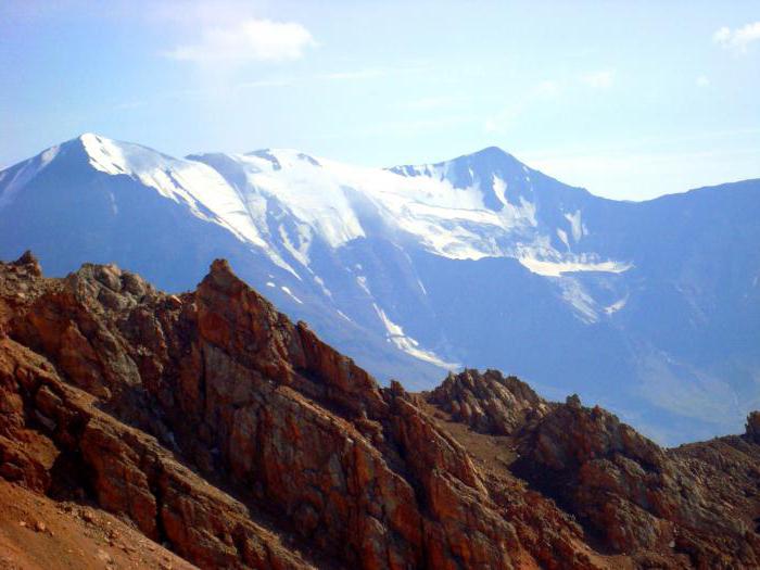
Mount Bazardyuzyu is the peak of the Great Caucasus watershed ridge and is located on the border of Dagestan and Azerbaijan; It is widely known as the southernmost point of Russia. The height reaches 4466 meters. Bazarduzu is the last node of the ridge of the Main Caucasus, behind which a gradual decrease in relief is already noticed. On the slopes of this peak, a large number of reservoirs arise, including some tributaries of Samur. Mount Bazardyuzyu (coordinates below) has a specific surface, which is nival-glacial and erosive-denudation. In the northwestern parts of this massif, traces of modern ice cover are pronounced. There are also weathering processes that play a significant role in creating relief. The formation of depressions on the slopes, deep placers and nival niches is associated with it. The valleys of this massif are characterized by great depths (up to 1500 m), as well as the U-shape of the forms of gorges. Trog valleys are an exception, since their slopes are relatively shallow, about 400 m and have a length of up to 9 kilometers. The width of these valleys is more than 200 m. Mount Bazardyuzyu has a huge area of glaciation: according to some reports - about 4 km 2 .
Glaciers
Bazarduzu glaciers are the eastern group of formations not only in the Dagestan region, but also in the Main Caucasus. North of this peak are two more - Tikhitsar and Murkar, which have five hanging lobiform tongues. The most accessible is the Tikhitsar glacier, less than a kilometer long and about 200 meters wide.
Flora and fauna
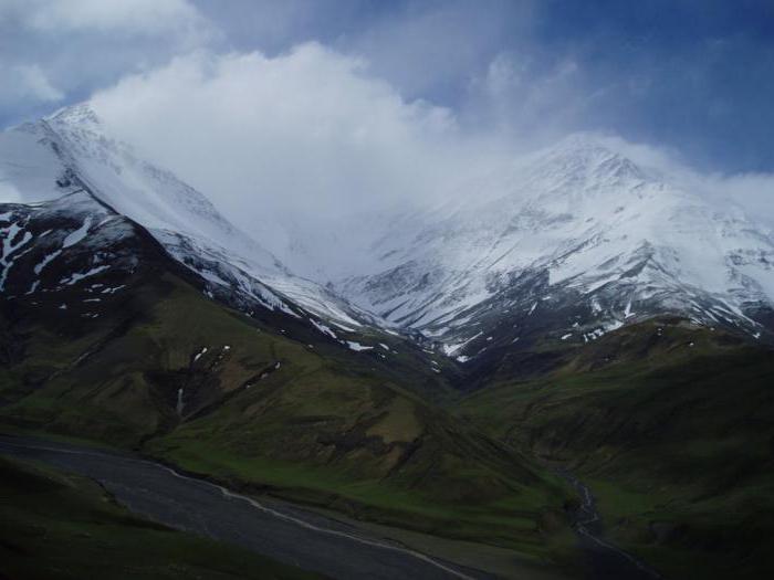
Despite the harsh living conditions, the animal world of such a peak as Mount Bazardyuzyu remains rich and peculiar. Roe deer, chamois and large herds of the Dagestan tour were preserved in this massif. In inaccessible places, mountain glaciers are found near glaciers . At the foot of this mountain are green meadows where local shepherds graze livestock. Light chestnut and sandy loamy soils prevail in the flat part, and mountain forest and chestnut soils dominate in the foothills . The climate in this region is moderately cold, with manifestation in annual temperature amplitudes, both in the lowlands and on the hills. Sharp diurnal fluctuations and deficit of moisture prevail also on the hill - such are the climatic conditions at such a peak as Mount Bazardyuzyu. Location coordinates explain this. The maximum temperatures of this region do not exceed 20 0 C, in the lowlands the absolute maximum is 35-40 degrees Celsius. Precipitation in low-lying areas varies in the region of 350-400 mm, in the mountains, at an altitude of about 3 kilometers, this figure is more than 1000 mm.
Geographic coordinates of Mount Bazarduzu
For many, Bazarduzyu is the extreme point of Russia. However, of course, given the official data on its location (41 ° N and 47 ° E), it immediately becomes clear that the peak is not located on the border of a great power. Moreover, this can be seen on any satellite map. Most likely, this error appeared due to the fact that the mountain has long been a clear reference point in this area. And in order to know for sure where Mount Bazarduzu is located, you should use accurate topographic maps.
Ponds
Thanks to the mountains of the Caucasus, and especially Bazardyuzyu, in the territory of Dagestan it is planned to build 3 hydroelectric power stations on the Samur River and its main tributaries coming from this peak. Also, over the past 100 years, a large number of new lakes have appeared in this area, located in the low part of the foothills. In the Caucasus, all lakes have a lagoon-marine origin and are located in arid regions. Ponds in the mountainous part of the massif are flowing, in the lowland - drainage and shallow. Mineral springs flow into many of the lakes in the region.
Title
Due to its location between the two states, this area has long been known as a border sign, as a result of which in ancient times there was a huge market square at the foot of this peak. Even the name “Bazarduzu” is translated from the Turkic and Azerbaijani languages as “bazaar square”. Large multinational fairs were held in the Shahnabad valley every year, not only the local population of the two neighboring countries came here, but also neighbors: Armenians, Georgians, Persians, Arabs, Jews, tsakhurs, Kumyks, Indians and many other nations. Local Lezgins nicknamed the peak - "Kichensuv", which means "mountain of fear."
Since Mount Bazardyuzyu is the dominant among fellow peaks, it can be seen even over a dozen kilometers. In the Middle Ages, caravans in these places were guided only by it.
Conquering the mountain
The first official and documented climb to this mountain, the highest point in Azerbaijan, is the climb of Russian topographers in 1847, headed by K. Alexandrov, whose main task was to establish a triangulation tower on top. After 50 years, two Englishmen conquered the mountain. The famous historian G. Anokhin also overcame this route. To the north-east of the mountain is the Karanlyg pass. Due to its relief, it allows you to overcome the path much easier, since it has a mostly gentle slope.
Nowadays, Bazarduzu mountain (photo is in the article) is a great place for climbing, attracting a large number of tourists with this feature. Near the foot there are a large number of climbing camps, where they also provide climbing training services.